This last entry is dated October 27, but I didn’t actually post it until November 27 because I wanted to update the other pages of my hiking site (like my annotated map, gear list, reading list, and Ori-Lou’s detailed account of our hike from Clingmans Dome to Fontana Dam [PDF]) first. Unfortunately I managed to put off doing that for a month once I got home. Sorry for the suspense! Thank you to everyone who followed along with my trail reports as I hiked, it was fun.
I couldn’t have asked for better weather during my last week on the trail. It was sunny and clear every day so I spent seven of my last nine nights under the stars (which I could actually see, thanks to a good portion of leaves now acting as carpet rather than canopy), a nice change of routine after spending almost every night since Hot Springs in a hostel/motel or shelter. It’s nice to get outdoors and connect with nature every now and then while hiking the trail.
I hiked out of Hiawassee with Golden, a thru hiker who, like me, is a flip-flopper: she hiked the first part of the trail going north from VA, then hitched back to her starting point and finished on Springer going south. Except I’m not a thru hiker… mostly because of those 368 zero days I did after Katahdin. But I have now hiked the entire AT (and got to share the excitement of finishing with both northbounders and southbounders) so my youngest sister cannot make fun of me for only doing half of it anymore. And that’s the important thing.
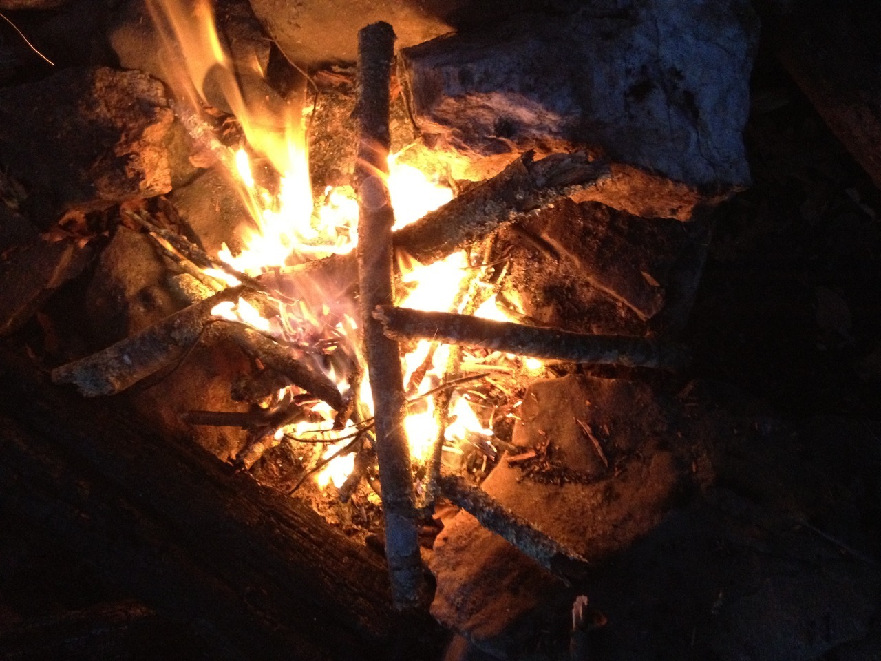
Golden had made friends with some locals, and one of them kindly gave us both a ride from the inn back to the trail head. We camped on top of Rocky Mountain that night. It was warm and pretty, and its name reminded me that I was headed back home to the Rocky Mountains very soon. Neither Golden or I had ever made a fire while on the AT, so we decided to give it a try. It turns out we’re pretty awesome at it (thanks to Golden for the photos):
In the morning we ate breakfast while the sun rose, then I started off for one of my last full days on the trail (Golden was taking her time because she was meeting family at Neels Gap the next day and didn’t want to get there too early.) I never met any other thru hikers before reaching Springer Mountain.
The next two days were nice 18-ish mile walks through autumnal Georgian woods. My last night on the trail I met a friendly section hiker named Snack Pack who gave me several little candy bars and M&M packages to celebrate my completion of the trail. Trick-Or-Treating a week early!
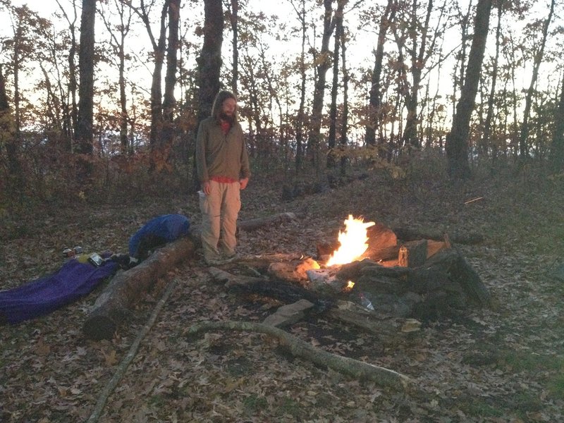
On the morning of my last day I hiked about 12 miles to where my dad was camping near the trail. I found him without problem, and we hiked the remaining few miles to the Springer summit, did the finished-this-trail photos and snack eating (I packed a Snickers bar from Neels Gap special for the occasion), then walked a mile back to the parking lot where he left his rental car. We then drove towards Atlanta, stopping at a Waffle House, Subway, and a night at a Days Inn (with continental breakfast!) on our way to the airport and our flights back to Denver.
So I’m now in a position to compare and contrast the northern half of the Appalachian Trail with the southern half. First, the flip-flop schedule of going north with the summer and south with the fall worked out very nicely weather-wise (and seems like a good plan whether as a semi-thru hike like mine or as a true thru).
I spent 64 days (August 23 to October 25) and 1,020 miles going south from Harpers Ferry to Springer Mountain. That section of trail at that time of year is very nice because of the lack of mosquitoes and ticks, I had relatively little rain but still had good water sources throughout (for the most part), the terrain is relatively quick and easy (only a small portion of the rocks and roots and steep climbs the northern half provides), and the autumn leaves make for picturesque hiking, especially from the Great Smokey Mountains onward.
I spent 95 days (May 17 to August 19) and 1,165 miles going north from Harpers Ferry to Mount Katahdin. That section, at that time of year, provides more challenges than its sourthern counterpart, mostly in the form of blood-sucking insects and arachnids, but also as rockier and steeper terrain which makes for angry feet. There were blueberries in New Hampshire and Maine while I was there, which was a treat.
Overall my general advice would be to find out where and when blueberries are ripening along the trail, and go hike there.
 Diode
Diode